Introduction
Researchers at RMIT University have developed innovative satellite imagery technology to detect plastic debris on beaches, aiding clean-up efforts and combating ocean pollution.
The Problem
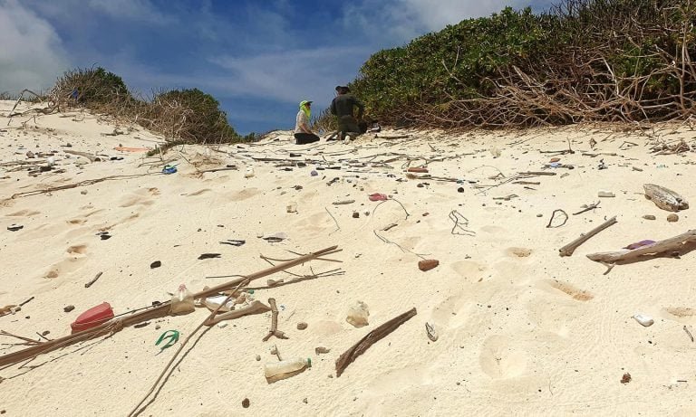
Over 10 million tonnes of plastic waste enter oceans annually, harming wildlife and ecosystems. Existing technology struggles to track plastic on beaches, where it blends with sand.
The Solution
The Beached Plastic Debris Index (BPDI) uses spectral analysis to identify plastics by reflecting light patterns. This method:
- Detects plastics from 600km above
- Differentiates plastics from sand, water, and shadows
- Utilizes high-definition WorldView-3 satellite data
Key Findings
- Field tests outperformed existing indices
- BPDI effectively identified 14 plastic targets on a Victorian beach
- Enhanced separability from water and sand
Expert Insights
- Dr. Jenna Guffogg: “Plastics harm wildlife, habitats, and ecosystems. Remote detection enables targeted clean-ups.”
- Dr. Mariela Soto-Berelov: “Satellite imagery captures large areas, facilitating detection and planning.”
Future Prospects
- Real-life scenario testing
- Partnering with organizations for implementation
- Contributing to Sustainable Development Goals (Protecting Seas and Oceans)
References
- Guffogg et al. (2024). Beached Plastic Debris Index. Marine Pollution Bulletin.
- RMIT University. (2024). Satellite technology tracks beach plastics.